Aerial Imagery

Bare Soil Images:
Use for soil-type identification, determining sample locations, variable-rate application and many other uses.
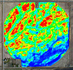
Colorized Images:
Aerial imagery presented in false-color for further analysis.
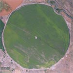
Crop Canopy Images:
See crop variation across field. Target stressed areas. Identify pivot system problems.
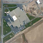
Special Interest:
Uses include: insurance claims, construction, residential, real estate, forestry, appraisal, land-use and assessment.